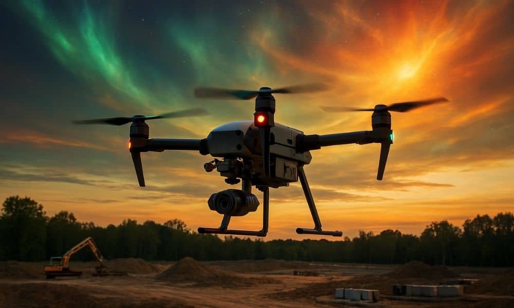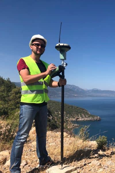
Drone land surveying is one of the most reliable tools for mapping land. Crews depend on it to collect accurate data fast, whether they are working on subdivision layouts, flood studies, or construction projects.
But during the week of September 7–9, many local surveyors noticed something strange: their GPS signals kept dropping, their drones struggled to hold fixed solutions, and jobs took longer than expected. The culprit? A wave of solar storms shaking up the atmosphere and disrupting the satellite signals surveyors depend on.
What Happened in Early September
NOAA’s Space Weather Prediction Center reported G2–G3 level geomagnetic activity around September 1–2, with disturbances continuing into September 6–8. That activity might not sound dramatic, but it’s enough to scramble the Global Navigation Satellite System (GNSS) signals used by survey drones.
At the same time, news outlets in Europe were reporting widespread GPS jamming, including a story about flight disruptions tied to the European Commission President’s plane. While that jamming happened thousands of miles away, the headlines reminded everyone just how fragile GNSS can be. Together, these two events brought global attention to a problem that surveyors felt in real time.
How Solar Storms Disrupt Drone Land Surveying

Solar storms release charged particles that collide with Earth’s atmosphere. When that happens, the ionosphere—the upper layer of the atmosphere—becomes unstable. GNSS signals pass through this layer, so the turbulence makes positioning less reliable.
For drone land surveying, the impact is clear:
- Fixes that normally lock in within seconds may take minutes.
- Coordinates that should be accurate to a few centimeters drift by several feet.
- RTK corrections from a network or base station lose stability.
Imagine flying a drone over a new development site. You’ve set out ground control points, calibrated the equipment, and are ready to start mapping. Suddenly, the drone drops from “fixed” to “float,” and your confidence in the data drops with it. That’s exactly what many crews experienced during the storm window.
Local Impacts in Ringgold
Surveyors rely heavily on drones for subdivision plats, grading checks, and topographic surveys. When GNSS falters, projects that usually take half a day stretch into full days or more.
For example, a boundary survey near Creek might normally wrap up before lunch. But during the storm, crews had to pause flights, extend hover times, and recheck ground control points. Those delays meant explaining to clients why a “simple job” suddenly required extra hours.
The lesson? Accuracy matters more than speed. Explaining to a homeowner or contractor that the delay prevents future disputes or construction errors can turn frustration into understanding.
Why It Matters for Clients
Most clients don’t know what the Kp index is or why a solar storm can change their closing date. What they do know is that bad data leads to expensive problems. An incorrect property line can spark neighbor disputes. A misaligned elevation model can throw off drainage plans. A mistake in a construction stakeout can cost thousands in rework.
By slowing down and double-checking work during the storm, surveyors protected their clients’ investments. In a field where precision is everything, patience during tough conditions shows professionalism.
Adapting in the Field
Survey crews in Catoosa County didn’t throw up their hands when GNSS signals weakened. They adapted. Some extended observation times for ground control. Others logged raw data to process later with post-processed kinematic (PPK) methods. Crews also leaned on local Continuously Operating Reference Stations (CORS), like the one across the state line in Chattanooga, to sanity-check their results.
Drone land surveying is flexible enough to handle these challenges, but it requires knowing when to pause and when to change methods. The smartest teams didn’t try to force through unstable flights—they balanced technology with good surveying judgment.
What Surveyors Learned This Week
The September storms were a wake-up call. They showed that even with advanced drones, RTK networks, and fast processing, surveyors still need a backup mindset. Some of the takeaways for Ringgold professionals include:
- Always monitor space weather. A quick glance at NOAA’s dashboard before heading out can save wasted trips.
- Explain delays early. Clients appreciate honesty when technology hiccups happen.
- Stay versatile. When RTK won’t cooperate, fall back on PPK, total stations, or static observations.
These lessons will stick with crews long after the storm clouds clear.
The Bigger Picture
Solar storms won’t happen every week, but they remind us that GNSS is vulnerable. In the future, both intentional jamming and natural interference may become more common. For surveyors, the best defense is awareness, planning, and communication.
Drone land surveying remains one of the most powerful tools in modern surveying. It cuts field time, improves safety, and delivers high-quality results. But as this week showed, even cutting-edge technology has limits. The surveyors who earn client trust are the ones who prepare for those limits and explain them clearly.
Final Thoughts
The next time GNSS signals wobble during a flight, crews will remember the first week of September 2025. They’ll know that solar storms can knock accuracy off course, but they’ll also know how to respond.
For property owners, developers, and engineers, the takeaway is simple: trust surveyors who put precision ahead of speed. A short delay today is far better than a costly mistake tomorrow.
If you’re planning a project, work with licensed professionals who understand both the sky above and the ground below. With the right team, drone land surveying stays reliable—even when the sun tries to interfere.


