LiDAR Mapping Reveals Hidden Terrain Risks on Properties
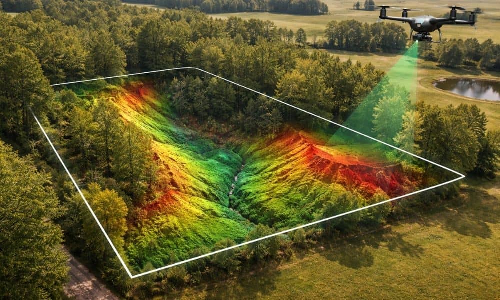
Buying land can feel simple at first. A property may look flat, quiet, and ready for building. However, the ground often hides important details. Small changes in elevation or uneven soil can create problems later. Because of this, many property owners now rely on lidar mapping to understand their land before making big decisions. In […]
ArcGIS Update Makes Survey Mapping Faster and Easier

Surveying land and turning field data into useful maps can be slow and tricky. You collect information in the field, bring it back to the office, clean it up, make maps, and then share them with clients or use them for planning. Thankfully, things are changing. The latest update to ArcGIS Online gives survey teams […]
Viral Fence Dispute Shows Why a Residential Surveyor Matters

A fence should make life easier. It adds privacy, keeps pets safe, and marks the edge of your yard. However, a fence can also start a serious neighbor fight. Recently, a fence dispute went viral online. Two neighbors argued about where the property line really was. One homeowner built a fence. The other claimed the […]