Recently, the City of Roswell, just north of Atlanta, Georgia, approved a $43,300 contract for a topo survey. This might seem like a small detail, but for those working in construction, engineering, or development across the Atlanta metro area, it’s actually a significant step.
This survey kicks off the Riverside Road “Complete Streets” Project, a city-led plan to make one of Roswell’s key corridors more walkable, safer, and easier to navigate for cars, bikes, and pedestrians. But before any concrete is poured or bike lanes are painted, the city needs to understand exactly what’s on the ground—and that’s where a topo survey comes in.
What Is a Topo Survey?
A topo survey is basically a detailed map that shows all the natural and man-made features on a piece of land. This means it captures everything from hills and slopes to trees and buildings. It also includes important details like drainage systems, roads, curbs, sidewalks, and utility poles or lines. Sometimes, it even shows property lines if needed.
Unlike a boundary survey, which only marks legal property lines, a topo survey gives you a clear picture of what’s really there on the ground—both above and sometimes below the surface. Because of this, it’s especially useful during the early stages of construction or engineering projects when knowing the exact terrain is key.
Why Did Roswell Need One?
Roswell’s “Complete Streets” plan focuses on a 7,000-foot stretch of Riverside Road. The city wants to improve the area for everyone—drivers, cyclists, and pedestrians alike. This means adding sidewalks, bike lanes, crosswalks, and possibly even stormwater upgrades.
But before engineers can draw up any plans, they need to know:
- Where the road slopes
- Where trees and utilities are located
- How water drains after rain
- Where private properties meet public land
- How much space they actually have to work with
The topo survey answers all of these questions. It’s like the eyes of the project—without it, the city would be designing in the dark.
What’s Included in the Roswell Survey?

According to the city council’s decision, the survey will cover:
- 7,000 linear feet (about 1.3 miles) of road
- Drainage features, which are crucial for stormwater control
- Utility locations, so nothing gets hit or damaged during construction
- Trees over 6 inches in diameter, especially important because Roswell has tree protection rules
- Road intersections, which are often the trickiest parts of any project
- About 40 individual properties, since the road runs next to both homes and businesses
The city approved a budget of $43,300 for the topographic work. The survey will serve as the foundation for the roadway’s design and future improvements.
Why Topo Surveys Are Essential in Public Projects
Topo surveys are more than just paperwork. They help avoid costly mistakes and delays down the road. Here’s how:
- They reduce guesswork. Engineers can design around real-world features, not just assumptions.
- They catch hidden problems. Poor drainage or elevation mismatches can ruin a project if not caught early.
- They help with permitting. Cities often need accurate maps before approving changes to roads or sidewalks.
- They build community trust. When a city shows it understands the local terrain, people feel more confident in the project.
In short, topo surveys make complex public projects possible—and they help keep them on time and on budget.
What Tools Are Used in a Topo Survey Today?
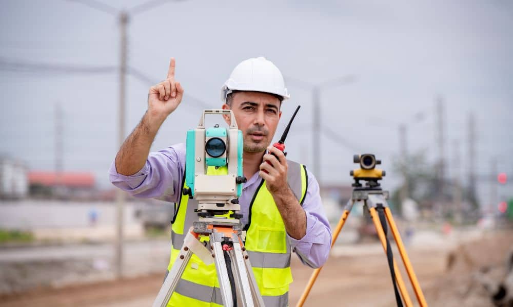
Traditionally, surveyors used tools like tripods, measuring wheels, and hand levels. Those still matter, but today’s surveys are much more high-tech. In Roswell’s case, the firm may use:
- GPS equipment for pinpoint accuracy
- Total stations that track angles and distances
- Drones (UAVs) with cameras or LiDAR sensors to map wide areas quickly
- 3D modeling software to turn raw data into digital maps engineers can use
Using drones or LiDAR makes it easier to cover large or hard-to-reach areas, especially when dealing with trees, creeks, or traffic.
What Should Surveyors and Clients Take Away from This?
Whether you’re a licensed land surveyor, a civil engineer, or a property developer, the Roswell project holds some valuable lessons.
For Surveyors:
- Municipal contracts are growing. Cities need accurate surveys for infrastructure and transportation projects.
- Topo scope is expanding. It’s not just about hills anymore—clients want data on utilities, trees, and ADA compliance too.
- Drone and LiDAR skills are in demand. If your firm isn’t using these tools yet, you might miss out on jobs like this.
For Clients (Builders, Developers, or Homeowners):
- Budget for a topo survey early. Don’t wait until design starts—it’ll only slow things down.
- Know what you’re asking for. Not all surveys are the same. Ask for one that includes elevation, utilities, drainage, and trees if needed.
- Work with local experts. Firms that know terrain and local codes (like tree protection laws) are more likely to deliver accurate, useful results.
Why This Story Matters
Roswell isn’t the only city doing this. Across Metro Atlanta, local governments are launching “Complete Streets” and other infrastructure upgrades. From Decatur to Sandy Springs, these projects often start with the same thing: a solid topographic survey.
So whether you’re working, you can expect to see more of this kind of work. And if you’re a surveyor or developer, it’s smart to stay ahead of the trend.
Final Thoughts
A $43,000 survey might seem like a small detail in a big city project, but it’s actually one of the most important steps. It’s the foundation—literally and figuratively—for everything that follows.
So next time you see new sidewalks, bike lanes, or smoother streets, remember: it probably started with a topo survey. And if you’re involved in building anything—from a road to a subdivision—make sure you’re getting the data you need before the design begins.


