Why Construction Surveying Is Evolving
Construction projects today are moving faster than ever, and accurate data is key to keeping them on track. Traditional tools like total stations and GPS are still useful, but they’re no longer the only options. One technology that’s rising fast in the industry is LiDAR mapping.
Used in construction surveying, LiDAR gives crews a fast, safe, and detailed look at the land they’re working with. It’s not just about collecting data—it’s about making smarter decisions before, during, and after the build.
What Is LiDAR Mapping in Construction Surveying?
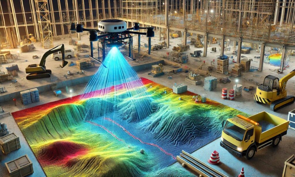
LiDAR uses laser beams to measure the distance between the sensor and objects on the ground. The laser reflects back, and that information is turned into 3D models of the site.
In construction, LiDAR sensors can be mounted on:
- Drones (UAVs) – for aerial surveys
- Vehicles or tripods – for ground-based scanning
- Backpacks – for indoor or mobile site work
This flexibility makes LiDAR ideal for construction surveying, where every inch counts and terrain changes constantly.
Benefits of Using LiDAR on Construction Sites
LiDAR isn’t just flashy tech—it’s genuinely useful on real job sites. Here are some reasons more construction teams are using it:
1. Fast and Accurate Surveys
You can scan large job sites in a matter of minutes or hours, depending on size. The result? Detailed point clouds that show elevation, slopes, and obstacles with incredible accuracy.
2. Better Safety for Crews
Since LiDAR can be operated from drones or vehicles, it reduces the need for workers to walk through dangerous or uneven terrain. It’s especially helpful on steep slopes, busy roads, or muddy construction zones.
3. Real-Time Decision Making
With fast data collection and quick processing, project managers can access up-to-date models of the site. This means changes can be made on the fly, and issues can be caught early—saving time and money.
Key Applications of LiDAR in Construction Surveying
Here’s where LiDAR mapping in construction surveying really shines:
Pre-Construction Site Analysis
Before breaking ground, teams can use LiDAR to understand the land. It helps identify slopes, drainage patterns, and grading challenges, so designs can be adjusted ahead of time.
Earthwork and Volume Calculations
Need to know how much dirt to move? LiDAR creates 3D terrain models that make it easy to calculate volumes for cut and fill operations.
Progress Tracking and Quality Checks
LiDAR scans can be repeated over time to track progress. You can compare models to see how much work has been done—or if something doesn’t match the plan.
As-Built Documentation
After construction is complete, LiDAR provides a detailed “as-built” model. This is useful for records, inspections, and future maintenance.
How LiDAR Enhances Construction Accuracy and Efficiency
LiDAR data can be integrated into CAD and BIM software to guide everything from grading to structure placement. It also works well with GPS-controlled machinery, helping bulldozers and graders work to exact specs.
Surveyors and engineers no longer have to rely on rough sketches or outdated plans. With LiDAR, they have a live look at the site—updated as often as needed.
Best Practices for Using LiDAR in the Field
If you’re thinking of adding LiDAR to your construction workflow, here are a few tips:
- Pick the right platform: Aerial LiDAR is great for large sites; mobile or ground-based is better for close-up detail.
- Use trained personnel: Whether it’s in-house or hired, skilled technicians are essential to collect and process data correctly.
- Choose good software: Tools like Civil 3D, Trimble, or Global Mapper make it easier to turn raw data into useful models.
Challenges and Considerations
LiDAR isn’t perfect, and there are a few things to think about:
- Upfront cost: Equipment and software can be expensive, but the long-term time savings often make up for it.
- Training needed: Interpreting point cloud data isn’t always simple. Make sure your team—or vendor—knows what they’re doing.
- Weather limits: Rain, fog, and strong wind can affect drone flights or data clarity.
Despite these issues, most surveyors agree that the benefits outweigh the drawbacks.
Real-World Applications
LiDAR is already being used across the industry. Here are a few examples:
- Highway construction: LiDAR scans help map right-of-way lines, guide drainage designs, and track grading progress.
- Commercial buildings: From initial site planning to rooftop modeling, LiDAR gives a complete view of complex builds.
- Earthmoving projects: Contractors use it to calculate volumes, monitor excavation, and reduce overdigging.
FAQs
1. Is LiDAR better than GPS for construction sites?
They work well together. GPS gives precise points, while LiDAR gives detailed surfaces. Together, they provide the full picture.
2. How often should I scan a construction site with LiDAR?
It depends on your project. Weekly or monthly scans are common for tracking progress.
3. Can LiDAR mapping replace traditional surveying completely?
Not always. It complements traditional methods and speeds things up but doesn’t replace legal boundary surveys or licensed decisions.
4. Is drone LiDAR legal on job sites?
Yes, but drone pilots must be certified and follow local airspace rules.
5. How long does it take to process LiDAR data?
Anywhere from a few hours to a few days, depending on site size and software power.
Final Thoughts
LiDAR mapping in construction surveying is more than just a tech trend—it’s a practical solution for modern job sites. It helps teams plan better, build smarter, and avoid costly mistakes.
If you’re in construction and looking for ways to improve accuracy, safety, and speed, LiDAR might be exactly what your next project needs.