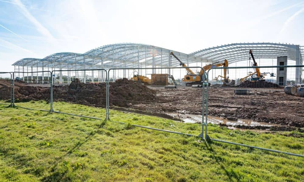
A warehouse column grid looks simple on paper. Each column sits at an exact spot, spaced to match the building’s design. The hard part starts when that grid has to move from the drawing to the open ground. A construction staking survey does this work. It turns the column plan into real points a crew can build from, before any concrete gets poured.
Savannah has good reason to pay close attention to this step right now. Industrial growth in the region has pushed several large warehouse projects into active construction. Some planned developments cover well over a million square feet in their first phase alone. A building that size needs a column grid that stays accurate across a long distance. Even a small error can throw off an entire section of the structure before anyone catches it.
Translating Warehouse Column Grids From Plans to Field Control
A construction staking survey starts with control points. These are fixed spots with known coordinates and elevations. Surveyors set up a network of these points across the site. Every column location gets measured out from that network. Then it gets marked in the field with a stake, pin, or paint mark. That mark shows the crew exactly where a column base or a group of anchor bolts belongs.
This step matters because a column grid usually starts from one baseline or corner on the drawing. If that starting point shifts even a little during the move to the ground, the error carries through every column tied to it. A tight, well-recorded control network keeps that risk low. This matters even more on a warehouse footprint that can stretch several hundred feet in each direction.
The column grid itself usually comes from the structural engineer, not the architect. Column spacing depends on beam length and how the building carries its load, not on the interior layout. Surveyors work from whichever drawing set the project team says is current. Architectural and structural plans do not always stay in sync during design changes.
Where Column Grid Layout Conflicts Usually Surface
Column grid problems tend to show up in the same few spots. Corners and building edges cause trouble often. A small rotation error grows bigger the farther a point sits from the original control reference. Loading docks and truck courts can also cause friction. Column lines sometimes need to clear equipment paths or dock doors that got finalized after the grid was first drawn.
Utility conflicts are another common problem on warehouse sites. A column position pulled straight from the structural grid can land right on top of a planned underground line or a utility easement. Catching this during staking, instead of after digging starts, gives the design team time to fix it. That is much cheaper than fixing it later.
Grading and slab height can cause issues too. On a site where the ground has been rough graded but not finished, staked column points sometimes need to get checked against the real ground elevation before crews trust them for footing work.
Setting Staking Tolerances Before Foundation Work Advances
Every construction staking survey works inside a tolerance. This means an accepted amount of difference between the planned spot and the staked spot. For a column grid, that tolerance is usually tighter than what works for general site grading. Even a small gap can affect how steel connects at the top of a column or how a precast panel fits into its bay.
The right tolerance for a project should come from the structural engineer’s specs or the project’s governing standard. It should not be a random number applied to every job. A warehouse built with steel framing may need a different tolerance than one built with tilt-up concrete panels, since the connections work differently.
Before foundation work moves forward, it helps to confirm the staked points fall inside the approved tolerance. Any gap should get written down and reviewed. Waiting until after the concrete gets poured to catch a tolerance problem leaves almost no way to fix it cheaply.
Coordinating Grid Revisions Without Losing Site Control
Column grids change during construction more often than most owners expect. A revised structural detail, a new equipment layout, or a shift in dock door spacing can move one or more column lines after staking has already started. When this happens, the goal is to update the field layout without losing the control network that ties everything together.
A construction staking survey built on a solid control network makes these changes easier to handle. Surveyors do not need to rebuild the whole grid. They can recalculate just the columns that changed, using the same fixed reference points. This keeps the rest of the staked grid untouched and avoids adding new error to areas already checked.
Clear communication between the general contractor, the structural engineer, and the surveyor matters here too. A change that gets staked in the field but never makes it onto the official drawings can cause confusion weeks later, especially if a different crew starts working from an outdated plan.
Column Grid Staking as Warehouse Projects Scale Up
Industrial corridor keeps drawing large warehouse and logistics projects. Some announced developments plan millions of square feet across several buildings on one site. Projects at this size often stake column grids for more than one building at a time. Sometimes they share a single control network across the whole industrial park.
This shared setup has real benefits. One control network means every building on the site ties back to the same coordinate system. That keeps roads, utility corridors, and each building’s grid lined up with one another. It also means a change to one building’s layout can get checked against the whole site instead of on its own.
As more of these large industrial sites move through construction, a construction staking survey that plans for future building phases from the start tends to save time later. Treating each building as its own isolated project usually costs more time down the road.
Frequently Asked Questions
Should warehouse column grids be staked from architectural or structural drawings?
Column grids should come from the structural drawings. Column spacing depends on beam length and load paths, not interior layout. Surveyors check with the project team to confirm which drawing set is current, since architectural and structural plans can get revised at different times.
Can column grid points be offset when construction equipment blocks the layout location?
Yes. When equipment or stored material blocks a column point, surveyors can set an offset stake at a known, measured distance from the true spot. The crew uses that distance to find the real column location once the area clears.
Does a construction staking survey include anchor bolt locations?
Anchor bolt layout is a separate and more detailed level of staking than the general column grid. Some projects ask for anchor bolt staking as part of the same survey. Others handle it later, once the foundation is ready for steel. Ask the surveyor ahead of time so nothing gets missed.