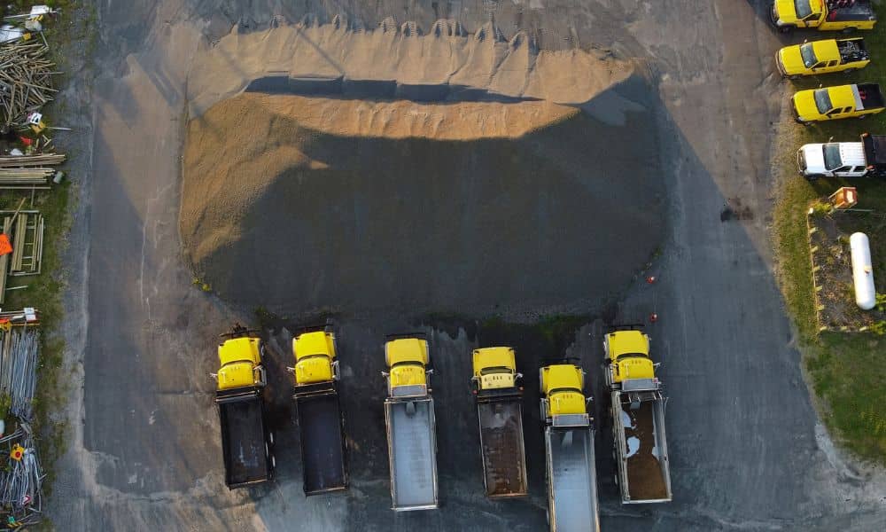
A pile of crushed stone can look right from the job trailer and still hold far less than the delivery tickets claim. Soil your crew dug out last month might sit in two places now, with part of it already under a building pad. Once quantities drift like that, every order and haul plan starts to rest on a guess.
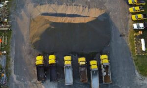
A drone survey measures stockpiles from the air and turns each pile’s shape into a volume you can check against your records. On active construction sites across Atlanta, trucks bring material in and haul it out all day. An independent count shows whether your numbers still hold before you order, haul or bill against them. How useful that count turns out depends on three choices you make before the flight: which piles to measure, how the surveyor defines the bottom of each pile and when the drone goes up.
When Material Quantities Stop Matching Project Records
Quantities stop matching when material moves around the site in ways the paperwork never captures. A drone survey gives you a measured volume of what’s on the ground today. You can hold that number up against tickets, haul counts and the original takeoff.
Records usually track trucks. A delivery ticket shows what left the quarry, and a haul count assumes every truck carried a full load. Out on the site, a loader borrows base stone to patch a haul road after a storm. A crew pushes part of a soil pile into a low spot, and excavated dirt might move twice before it lands where it belongs.
The survey shows how big the gap is and which piles hold it. You still have to find the cause, but a smaller target makes that search faster. To keep the numbers tied to your plans, the surveyor links the flight to ground control, which means points on the site with known positions. That puts every pile in the same coordinate system as your site plan and grading design.
Choosing Stockpiles Worth Including in the Drone Survey
Include the piles that affect cost, schedule or a decision coming up soon. A report crowded with every small pile on the site is harder to read and act on. Good candidates usually include:
- Imported fill, stone or base you pay for by the ton or yard
- Excavated soil you plan to reuse on site
- Material that affects a pay application or a supplier dispute
- Piles a new phase will start drawing from soon
- Topsoil you’re saving for final grading and planting
Leave out small piles that will move within a day or two. Skip piles mostly buried under pipe, forms or parked machines too. A drone records only the surfaces it can see from above, so anything sitting on or against a pile hides part of its shape.
Before the flight, mark the chosen piles on a site plan and give each one a name the whole team will use. “North select fill” beats “Pile 3” when someone reads the report six weeks later. Steady names also make the next survey easy to match with this one.
Why the Stockpile Base Can Change the Volume
A stockpile’s volume equals the space between the top of the pile and a surface underneath it, which surveyors call the base. Once material covers the ground, nobody can see that base anymore. The surveyor has to define it, and a different base gives you a different volume even when the pile hasn’t changed.
Construction sites make this trickier than a flat material yard. A pile might sit on a pad that slopes toward a swale or fill a low area left from clearing. It could also lean against an embankment or rest on older material. If the surveyor assumes a flat base under a pile that fills a hollow, the report misses material. If the ground rises under the pile, the report counts material that isn’t there.
The strongest base comes from data captured before the material arrived. When you know a large import is coming, ask for a quick topographic capture of the drop area first. Without that earlier data, the surveyor estimates the base from the ground around the toe, the line where the pile meets the ground. Whichever approach you use, keep it the same from flight to flight so a method change doesn’t show up as a false volume change.
Schedule Drone Surveys Around Meaningful Material Changes
Fly when the numbers are about to shape a decision. The best times are right before a large import starts, after a haul-off wraps up, ahead of a pay application and just before a phase begins pulling from a pile. A monthly flight can work on long jobs, but a flight tied to a real change tells you more.
Timing within the day matters too. A loader cutting into a pile during the flight can leave a surface that never existed at any single moment. Ask your superintendent to move equipment off the pile edges and pick a quieter window, such as a lunch break or the end of a shift.
Atlanta adds a couple of local factors. Commercial drone flights fall under the FAA’s Part 107 rules, and parts of the metro sit in controlled airspace around Hartsfield-Jackson Atlanta International Airport and the region’s smaller airports. The pilot may need FAA authorization before flying those areas, so build that lead time into your plan. Summer thunderstorms can also push a flight back, and a hard rain can slump soil piles or wash material down their sides.
Turn Stockpile Measurements Into Construction Planning Decisions
A measured volume helps you decide whether to order more material, stop an import or send extra soil off site. Those calls affect trucking, crew time and the schedule. A current number gives your estimator something firmer than last month’s guess.
Soil piles matter most for earthwork balance. Compare the reusable soil on site with the fill your grading plan still needs. Stockpiled soil is loose, though, and it takes up less room once crews place and compact it. Your engineer or geotechnical consultant can supply the factor for converting loose yards to compacted yards, so avoid matching the two numbers one for one.
Dated measurements help with money conversations too. If a supplier’s tickets and the site disagree, a survey with a clear date and method gives both sides something concrete to review. Share the report with your project manager, estimator and engineer so everyone plans from the same quantities.
Frequently Asked Questions
Can a drone survey measure stockpiles while construction remains active?
Often, yes. The pilot and your superintendent need to plan around moving equipment, workers on the ground and any restricted areas. Federal drone rules also limit flights directly over people, so the crew may adjust the flight path or timing to keep the drone clear of workers.
Can separate sand, gravel, soil, and aggregate piles be reported individually?
Yes, as long as the surveyor can tell where one pile ends and the next begins. Reports can list each pile by name with its own volume instead of one total for the whole site. Piles that run together with no clear edge are harder to split, so leave some space between different materials when you can.
Does a drone survey provide stockpile weight or only volume?
A drone survey gives you volume. To get tons, you multiply that volume by the material’s density, which can come from the supplier, a lab test or a field check. Moisture changes the math as well, since a soil pile soaked by a week of rain weighs more than the same pile when dry.