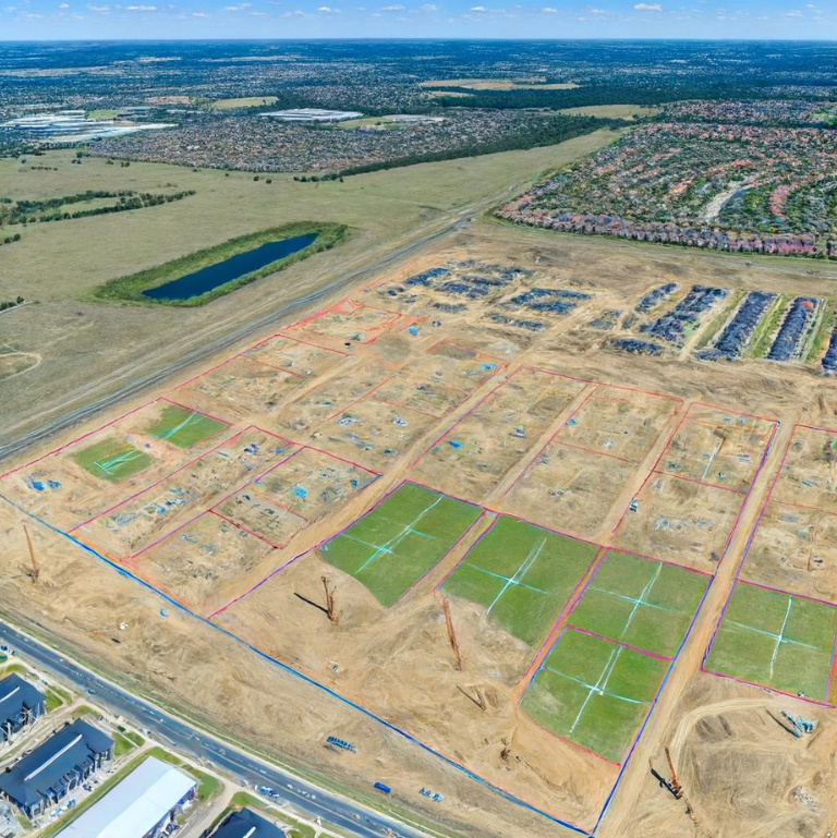
Before any commercial project begins in Atlanta, GA, a property survey is a must. It shows legal boundaries, easements, and land features that help developers plan better, avoid legal issues, and speed up permits. This article explains how surveys keep projects on track and why they’re essential for building in a busy city like Atlanta.
Atlanta’s Expanding Commercial Landscape
Growth of Commercial Development in Metro Atlanta
Atlanta’s commercial real estate market is booming. With major companies moving in and local businesses expanding, there’s a constant demand for new office buildings, retail plazas, and industrial sites.
Why Accurate Land Data is Essential
For developers, time is money. Starting a project without a proper survey can lead to zoning issues, building delays, or even legal trouble. That’s why accurate land data is a must from the very beginning.
Understanding Property Surveys in Commercial Projects
A commercial survey typically shows:
- Property boundaries and legal lines
- Easements and access rights
- Locations of buildings, roads, and utilities
- Elevation and topography details
- Any encroachments or potential zoning issues
Types of Surveys Used in Commercial Development
- ALTA/NSPS Surveys – the most detailed option, often required by lenders
- Boundary Surveys – used to confirm property lines
- Topographic Surveys – helpful for grading and drainage
- As-Built Surveys – used to verify finished construction matches the approved plans
How Commercial Surveys Differ from Residential Ones
Commercial surveys require more detail. They often include legal and zoning information, utility data, and environmental considerations that aren’t needed in most home surveys.
Benefits of Property Surveys in the Permitting Process
1. Zoning Compliance and Land Use Verification
Zoning laws in Atlanta are strict. A survey ensures the land use complies with local rules, helping developers avoid rejections during the permit process.
2. Meeting Environmental and Building Code Requirements
A survey can reveal flood zones, wetlands, or other sensitive areas. Knowing this early helps developers adjust plans and stay compliant with building codes.
3. Facilitating Easement and Utility Planning
Many commercial projects require water, sewer, and power connections. Surveys show where utilities are located and help developers plan access without breaking laws or damaging infrastructure.
Using Survey Data to Streamline Project Timelines
- Identifying Site Constraints Early. Surveys help spot problems before they become expensive delays. Slopes, drainage issues, or property encroachments are easier to fix before construction begins.
- Preventing Legal Disputes. A survey can prevent boundary disputes with neighboring properties, which could otherwise stop a project in its tracks.
- Improving Communication Among Project Teams. Architects, engineers, and contractors all rely on survey data to design, budget, and build. Having clear and accurate maps keeps everyone on the same page.
Real-World Examples of Survey-Driven Success in Atlanta
1. Retail Center Near I-285
A major shopping plaza near I-285 used a topographic and boundary survey to quickly clear zoning requirements, fast-tracking the permit process.
2. Mixed-Use Projects in Midtown
Surveys helped developers understand complex land conditions in Midtown, allowing for the smart placement of utilities and underground parking.
3. Industrial Sites in South Atlanta
Warehouses and logistics centers rely on elevation data from surveys to design proper drainage systems and ensure truck access complies with city regulations.
Choosing the Right Surveyor for Commercial Projects
- Licensing and Local Knowledge Matter. Always choose a licensed surveyor with experience in commercial work. In Atlanta, it’s helpful if they understand local codes and permitting processes.
- Surveyors Are Key Team Members. Surveyors often work directly with architects, engineers, and planners. Make sure they’re involved early in the planning phase.
- Review Deliverables and Timelines. Ask what you’ll receive—a digital file, hard copy, CAD drawings, etc.—and how long it will take. Clear expectations lead to fewer surprises.
FAQs
1. How Long Does a Commercial Survey Take?
It depends on property size and survey type. Small sites may take a few days, while complex projects could take 1–2 weeks.
2. Are Surveys Required for Rezoning or Variance Requests?
Yes. Most rezoning applications need a current survey to prove land use compliance and show how the property will be developed.
3. What Is the Cost Range for Commercial Surveys?
Costs vary based on property size and detail. Expect to pay:
- Boundary Survey: $1,500 – $3,000
- ALTA/NSPS Survey: $3,000 – $8,000+
- Topographic Survey: $2,000 – $6,000
4. Can a Survey Help with Land Acquisition?
Absolutely. A survey can reveal hidden problems like encroachments or utility restrictions, making it a key part of due diligence.


