Warner Robins, GA is quickly becoming a city to watch when it comes to innovation and smart growth. With new infrastructure projects on the horizon and a renewed focus on urban revitalization, local leaders are turning to advanced tools to guide their decisions. As more cities adopt smart planning tools, LiDAR Mapping in Warner Robins is becoming essential for modern infrastructure and development. From precise land measurements to real-time data visualization, this technology is helping transform the way Warner Robins plans, builds, and grows.
The Vision for Warner Robins’ Revitalization
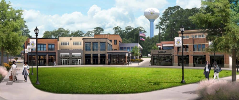
Downtown Warner Robins is getting a makeover. City leaders recently revealed bold plans for Commercial Circle, aiming to turn it into a vibrant, walkable district full of shops, eateries, and open spaces. But revitalization isn’t just about pretty buildings—it’s about smart planning, and that’s where LiDAR fits in.
The city’s broader goals include boosting local businesses, improving livability, and making Warner Robins a model for other growing communities. Technology like LiDAR ensures these plans are based on real data, not guesswork.
Role of Robins Air Force Base in Economic Development
You can’t talk about Warner Robins without mentioning Robins Air Force Base. It’s the city’s economic engine, employing over 22,000 people and generating billions for the region. As the base evolves and supports more high-tech operations, the surrounding city must keep pace.
LiDAR mapping supports this growth by helping map infrastructure near the base, plan new transportation routes, and improve flood control around critical facilities. It’s all part of creating a safer, more efficient environment for residents and workers alike.
The Power of LiDAR Mapping in Urban Planning
When cities plan new developments, they need to understand what’s already there—like terrain, buildings, roads, and utilities. Modern mapping technology provides highly detailed 3D maps that show every slope, elevation, and obstacle. Planners use this data to decide where to build, how to shape roads, and what areas may need extra support.
This is especially useful in downtown redevelopment. With LiDAR, Warner Robins can redesign streetscapes, green spaces, and public buildings with a clear picture of the existing landscape.
Enhancing Public Safety and Infrastructure Resilience
One big benefit of LiDAR is how it helps cities prepare for natural challenges. In Warner Robins, stormwater management is critical, especially with unpredictable weather. LiDAR can map drainage paths and low-lying areas to reduce flood risk.
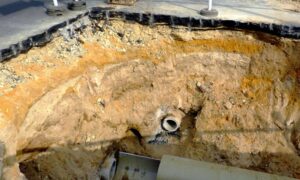
It’s also helping update water, power, and internet lines—key pieces of infrastructure that support both safety and growth. Knowing where these systems are (and how they interact with the land) allows the city to upgrade them without unnecessary delays.
Streamlining Construction and Development Projects
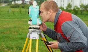
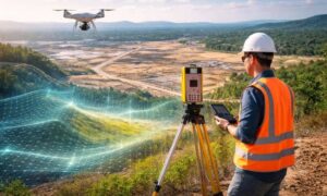
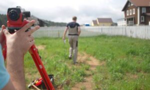
Time is money, especially in construction. With advanced land surveying technology like LiDAR, project timelines shrink because developers get accurate site data upfront. Instead of weeks of ground surveys, drones and scanners can complete mapping in hours. This helps contractors plan better, avoid rework, and stay on schedule.
In a city with as much planned development as Warner Robins, these efficiencies matter. They keep momentum strong and ensure projects are done right the first time.
LiDAR and Environmental Sustainability
Warner Robins is growing, but city leaders are committed to doing it responsibly. That means protecting green spaces, monitoring tree cover, and reducing environmental impact. LiDAR helps by identifying areas with dense vegetation, mapping watersheds, and analyzing how land use affects the environment.
This data supports smarter zoning, better park planning, and sustainable land use—all without harming the natural surroundings.
Supporting the PlanFirst Designation Goals
In 2025, Warner Robins earned the PlanFirst Designation from Georgia’s Department of Community Affairs. This award recognizes cities with strong, forward-thinking planning. LiDAR aligns perfectly with that vision.
By providing up-to-date, accurate spatial data, LiDAR makes it easier for the city to set realistic goals, track progress, and make data-driven decisions that benefit everyone.
Case Studies and Success Stories in Warner Robins
While some revitalization projects are still underway, others have already shown how effective LiDAR can be. For example, recent roadway expansions used LiDAR scans to avoid utility disruptions. Another project mapped potential retail expansion zones downtown, helping businesses choose the right spots.
As more projects roll out, expect to see even more examples of LiDAR’s value.
Integrating LiDAR with GIS and Smart City Tools
LiDAR data becomes even more powerful when combined with GIS (Geographic Information Systems) and smart city software. Together, these tools create real-time dashboards for city managers, showing everything from traffic flow to utility usage.
Warner Robins is just beginning to explore these possibilities, but the potential is huge—from managing growth more efficiently to improving services for residents.
Cost-Benefit Analysis of Using LiDAR in Public Projects
Sure, LiDAR equipment and services come with a cost. But when you weigh that against the savings from fewer mistakes, faster planning, and better long-term outcomes, it’s a solid investment.
Plus, grants and public-private partnerships can help offset the upfront price—making it accessible even for mid-sized cities like Warner Robins.
How Local Businesses Can Leverage LiDAR Mapping
It’s not just the city that benefits. Local businesses—from developers and surveyors to utility contractors and landscapers—can use LiDAR mapping to plan more efficiently and offer better services. Some companies are even launching drone-based LiDAR services right here in Middle Georgia.
It’s another example of how technology boosts both innovation and the local economy.
Potential Challenges and Solutions
Like any technology, LiDAR comes with challenges. Data management, staff training, and equipment costs can be barriers. But solutions exist:
- Partner with third-party providers
- Use cloud-based platforms to store data
- Tap into state funding or federal infrastructure grants
Cities that take these steps can implement LiDAR successfully without breaking the budget.
Expert Opinions and Future Outlook
Urban planners and tech experts agree: LiDAR is here to stay. It’s already essential in cities across the U.S., and Warner Robins is quickly joining that list. As new tools emerge—like AI-driven analysis and mobile LiDAR scanners—the technology will only get smarter and easier to use.
For Warner Robins, that means more informed decisions and a future built on solid data.
FAQs
1. What areas in Warner Robins are being revitalized?
The Commercial Circle area is the main focus, but other downtown spaces and public infrastructure are also part of the plan.
2. How does LiDAR help the local economy?
It improves planning, reduces construction delays, and helps attract investment by streamlining development.
3. Is LiDAR cost-effective for small cities?
Yes, especially when paired with grants or outsourced to service providers.
4. Can LiDAR data be used by the public?
In many cases, cities make certain datasets available for public access or via GIS portals.
5. What are the biggest benefits for infrastructure?
Faster mapping, better accuracy, and fewer disruptions during upgrades or repairs.
6. Are there any environmental concerns?
LiDAR is non-invasive and considered environmentally safe. It can actually help protect natural areas by identifying risks early.
Conclusion
As Warner Robins, GA continues to grow, it’s clear that success won’t come from guesswork—it’ll come from data-driven planning and smart technology. LiDAR mapping is helping make that possible. From revitalizing downtown to protecting natural spaces, it’s giving city leaders and businesses the tools they need to build a better tomorrow.
So whether you’re a city official, developer, or resident, LiDAR is quietly shaping the future around you—and it’s only just getting started.
