In recent years, LiDAR has moved beyond government and research settings. Now, small businesses, developers, and local companies in LaGrange, Georgia, are seeing its real-world value. As we step into 2025, LiDAR Mapping in LaGrange GA is no longer a luxury—it’s becoming a necessity.

Overview of the Business Landscape in LaGrange GA
LaGrange, nestled in western Georgia, has evolved from a manufacturing town into a diverse economic hub. From real estate and construction to utilities and forestry, its businesses are embracing modern solutions to improve efficiency and accuracy.
2025 is a turning point. With growing infrastructure demands, environmental concerns, and smart city initiatives, more businesses in LaGrange are looking for tools that offer clarity—and LiDAR fits the bill.
The Growing Importance of Geospatial Data in Business
Accurate geospatial data can make or break a project. Whether it’s planning a housing development or mapping utility lines, precision is key. Traditional surveying methods can be time-consuming and prone to error. That’s where LiDAR comes in.
By capturing thousands of data points per second, LiDAR provides detailed visuals and measurements. Businesses can make faster, smarter decisions—and reduce costly mistakes in the process.
How LiDAR Mapping Benefits Local Businesses
LiDAR isn’t just about pretty maps—it’s about actionable insight. Here’s how LaGrange businesses are reaping the benefits:
- Speed: What used to take weeks with manual surveying now takes days or even hours.
- Accuracy: LiDAR detects even small changes in elevation or topography, helping avoid surprises during construction.
- Cost Savings: Better data upfront means fewer project delays and rework.
Whether it’s planning utility networks or assessing land for development, the return on investment is clear.
Industry-Specific Applications of LiDAR in LaGrange GA
Construction and Development: Developers use LiDAR to map construction zones, detect slopes, and ensure compliance with zoning regulations.
Forestry and Agriculture: Landowners can analyze vegetation density, monitor tree growth, or plan efficient irrigation systems.
Telecommunications and Utilities: Companies rely on LiDAR to model powerlines, cell towers, and underground infrastructure with incredible detail.
Environmental Monitoring: From tracking erosion to identifying flood zones, environmental firms use LiDAR to protect both nature and people.
LiDAR Mapping and Small Business Innovation
You don’t need to be a major corporation to use LiDAR. Thanks to new service providers and tech accessibility, even small LaGrange businesses are joining the trend.
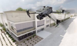
Local startups are using LiDAR to build drone-based services, offer property inspections, and analyze agricultural plots. These innovative uses are opening new doors and creating local jobs.
Case Studies of LiDAR Mapping Success in LaGrange
Case 1: A local construction firm saved over $50,000 by identifying drainage issues early using LiDAR scans.
Case 2: An agricultural co-op improved crop yields after analyzing field topography with drone-mounted LiDAR.
Case 3: The city itself used LiDAR for stormwater mapping, preventing flooding during heavy rains.
These are just a few examples proving that the technology isn’t futuristic—it’s already here and making a difference.
Challenges of Implementing LiDAR in Business
Of course, adopting LiDAR isn’t without challenges:
- Cost: The equipment and software can be expensive upfront.
- Training: Employees need time to learn how to interpret LiDAR data.
- Data Management: The sheer volume of data can overwhelm those without proper systems.
However, many companies are overcoming these hurdles by outsourcing to specialized LiDAR service providers in Georgia.
Future Trends: Where is LiDAR Heading in 2025 and Beyond?
Expect LiDAR to become even more powerful in the next few years. Here’s what’s coming:
- AI Integration: Artificial intelligence will make sense of massive datasets even faster.
- Cloud Processing: Uploading LiDAR data to the cloud means businesses can access it from anywhere.
- Real-Time Scanning: Mobile LiDAR systems will soon allow real-time updates on construction sites.
These advancements make the technology even more attractive to LaGrange businesses looking to stay competitive.
How to Get Started with LiDAR Mapping in LaGrange GA
Thinking of adopting LiDAR? Here’s a quick roadmap:
- Define Your Needs: What problem are you solving?
- Find a Trusted Provider: Many Georgia-based companies now offer LiDAR services.
- Check Local Regulations: Some mapping projects require permits or city approvals.
- Train Your Team: Even basic training helps your team understand how to use LiDAR outputs.
Environmental and Social Impact of LiDAR Mapping
LiDAR does more than help businesses—it helps communities too. Cities use it to plan green spaces, reduce flood risks, and improve safety. It supports smarter growth that balances economic and environmental needs.
LiDAR Mapping vs Other Mapping Technologies
Unlike GPS or photogrammetry (which uses images), LiDAR provides rich, 3D visuals—even in dense forests or dark conditions. It’s not always the cheapest method, but it’s often the most precise.
ROI: Measuring the Business Impact of LiDAR Investments
While the upfront investment might seem high, the long-term returns are significant. From project savings to improved safety, businesses in LaGrange are seeing LiDAR as more than a tool—it’s a strategic asset.
Expert Insights and Industry Predictions
Industry experts predict that by 2026, LiDAR will be a standard tool in industries like construction, energy, and agriculture. Economic planners in LaGrange agree: companies that adopt early will gain a major edge.
FAQs
1. Is LiDAR Mapping in LaGrange GA expensive?
Initial costs can be high, but many businesses see strong returns through faster, more accurate work.
2. Can small businesses afford to use LiDAR?
Yes! Many small businesses partner with third-party LiDAR service providers, making it affordable.
3. What industries benefit most in LaGrange GA?
Construction, real estate, agriculture, forestry, utilities, and city planning are top users.
4. Are there grants or incentives for using LiDAR?
Some state and federal programs offer funding for geospatial technology. It’s worth exploring local business resources.
5. How long does a LiDAR project take?
Depending on size and complexity, most projects are completed within days to a couple of weeks.
6. Is LiDAR safe for the environment?
Absolutely. It’s non-invasive and can be used without disrupting wildlife or habitats.
In 2025, LiDAR Mapping in LaGrange GA isn’t just a tech trend—it’s a practical, powerful tool that’s reshaping how local businesses operate. From boosting accuracy to unlocking growth, the benefits are clear.
As the technology becomes more accessible, expect even more businesses—big and small—to turn to LiDAR to stay ahead. If you’re in LaGrange and want to future-proof your business, now’s the time to explore how LiDAR can work for you.
