When it comes to building new neighborhoods or commercial sites, timing is everything. From grading to concrete pours, every phase depends on one critical step, construction staking surveys. These surveys translate your design plans into real-world points on the ground, ensuring every curb, sewer line, and building corner lands exactly where it should.
But what happens when the technology that powers these surveys slows down? That’s the question many in West Georgia are asking after recent news about LiDAR sensor delays. A major LiDAR company just announced layoffs and cash-flow problems. While that may sound like tech-industry gossip, it’s actually a big deal for local developers and surveyors in places like Carrollton.
Why This News Matters to Local Projects
LiDAR — short for Light Detection and Ranging — is what makes modern survey equipment so precise. It’s used in drones, scanners, and mapping systems to measure ground elevations and create detailed 3D site models. Many construction staking surveys depend on LiDAR-based tools for fast, accurate point data.
With the company cutting staff and slowing production, the supply chain for these sensors could tighten. That means longer lead times for replacements and higher prices for the gear surveyors rely on every day.
In simple terms: if your surveyor’s equipment breaks or needs recalibration, there might not be a quick fix.
What’s at Risk for Developers
Carrollton and the surrounding areas have seen steady growth in new subdivisions, commercial builds, and road expansions. These projects all rely on accurate layout surveys before a single footing or pipe is installed.
If sensor shipments slow or repairs take longer, developers could face:
- Scheduling delays. Crews can’t start work until the staking is complete. If surveyors can’t get their LiDAR drones or scanners back in service quickly, that delay can ripple through the whole project.
- Higher costs. Replacement sensors and calibration services might cost more as demand rises and parts become harder to find.
- Accuracy trade-offs. When advanced scanning tools are offline, some crews switch to older manual methods. Those still get the job done but often take longer and require more field checks.
- Tighter deadlines. Permits and lender schedules don’t pause just because a part is back-ordered. Developers may need to plan for extra time in their project timelines.
How LiDAR Ties Directly Into Construction Staking Surveys

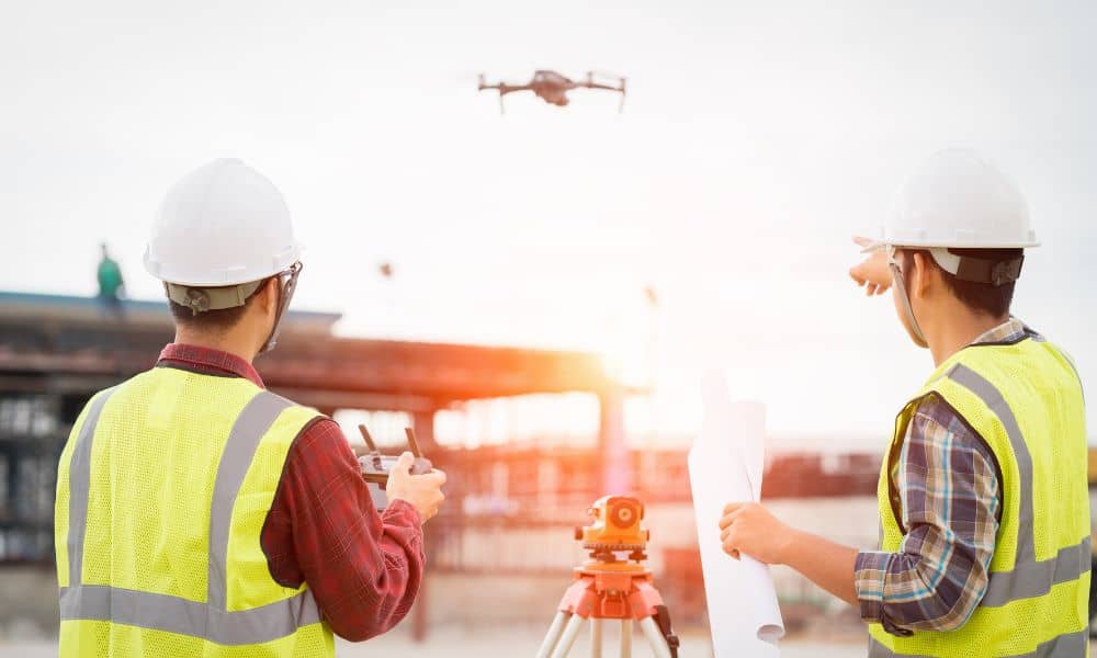
A lot of people still picture a surveyor with a tripod and prism pole — and that’s still part of the process. But much of today’s staking work also uses LiDAR-equipped drones or mobile scanners. These sensors create dense point clouds that help surveyors verify grade, slope, and cut-and-fill calculations before and after staking.
When those sensors are delayed, it’s like losing the eyes of your project. Surveyors can’t see the fine details that help prevent costly errors — such as a mis-aligned foundation or a drainage slope that doesn’t meet code.
That’s why a hiccup in the global LiDAR market can quickly show up on local job sites.
What Developers Can Do Right Now
The good news is that smart planning can minimize the risk. Here’s how developers and contractors can stay ahead:
1. Schedule staking early. Don’t wait until the week before excavation. Book your construction staking survey as soon as design plans are ready. That gives surveyors more flexibility to work around any equipment delays.
2. Ask your surveyor about their tech setup. Reliable firms diversify their tools. They may use multiple LiDAR brands or maintain backup systems. A quick conversation helps you understand how resilient their workflow is.
3. Build buffer time into your permits. Adding even a few extra days in your schedule can prevent stress later. It’s easier to adjust early than to rush inspections because of an unexpected delay.
4. Choose local expertise. Surveyors who know the terrain and have experience with both traditional and drone methods can pivot quickly. Local pros also tend to have faster turnaround for site revisits or re-stakes.
5. Stay informed about tech supply chains. When national news mentions sensor shortages or drone import slowdowns, it’s worth paying attention. Those stories can forecast local bottlenecks weeks before they hit.
Why Local Experience Still Wins
Technology moves fast, but boots-on-the-ground experience still makes the biggest difference. A licensed land surveyor can handle complex staking layouts even if high-tech gear goes down temporarily. Knowing the local benchmarks, soil conditions, and city permit requirements often saves more time than the newest gadget.
In Carrollton, that mix of human skill and smart tech is exactly what keeps projects moving forward. Even if LiDAR deliveries slow down, a seasoned surveyor can switch to alternate equipment or use prior site data to stay on schedule.
Looking Ahead: The Industry Will Adapt
The LiDAR news might sound alarming, but the surveying community is built on problem-solving. Manufacturers will likely stabilize production soon, and surveyors are already adapting with hybrid workflows — combining GPS, total stations, and aerial mapping tools to fill the gap.
For developers, the key takeaway is preparation. Treat your construction staking survey as an early-stage priority, not an afterthought. Secure your survey date early, keep open communication with your surveyor, and verify that your site data stays current as plans evolve.
Final Thoughts
A sensor delay halfway across the country can seem far removed from a construction site. But in today’s connected world, even a small disruption can echo through project schedules and budgets. The smartest builders plan for it.
So as you plan your next residential or commercial build, think ahead about who’s helping you keep things on track. Working with local experts who understand the terrain and permit process can make all the difference. If you’ve ever searched for land survey companies near me, focus on finding one that’s not just nearby, but dependable — the kind of surveyor who communicates clearly and adapts fast when the unexpected happens.
Because no matter how advanced the tech gets, the best way to keep your project moving is still simple: plan ahead, double-check your data, and stake it right the first time.
