
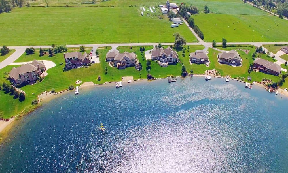
If you own a home along West Point Lake in LaGrange, you’ve probably heard about the new shoreline rules that went into effect on October 1, 2025. The U.S. Army Corps of Engineers (USACE) has rolled out the first major update to the Shoreline Management Plan since 1993, and it changes how lakefront property owners can use, clear, and build near the water. The update may sound technical, but at its core, it comes down to one simple question: where does your land end, and where does the Corps’ land begin? That’s why getting a property line survey right now could save you from costly mistakes, fines, and frustrating delays.
Why the New Rules Matter for Lakefront Owners
West Point Lake is one of LaGrange’s most valuable assets. It provides recreation, property value, and a sense of community for everyone who lives along its shoreline. Because of that, the Corps carefully regulates what can happen near the water.
The new rules tighten requirements for:
- Dock permits and maintenance – Old approvals may not carry over.
- Vegetation and brush removal – You can no longer clear shoreline without permission.
- Utility installations – Running water, sewer, or electrical lines near the lake now requires explicit approval.
- Shoreline allocation and permits – Only certain property owners qualify, and you need to meet updated criteria.
These changes are not just red tape. They’re meant to protect the shoreline, keep the lake safe for recreation, and prevent long-term damage. But for homeowners, they also mean any misstep could cause serious setbacks.
The Confusing Line Between Your Property and Corps Land
Here’s the challenge: many lakefront parcels don’t stop at the water’s edge. They often extend close to the shoreline, but the Corps maintains control of a strip of land along West Point Lake. The exact boundary line isn’t always obvious.
Some owners assume fences or tree lines mark the edge. Others rely on old plats that no longer match today’s conditions. But when it comes to new rules, assumptions won’t cut it. If you clear brush or extend a dock even a few feet into Corps property, you could face permit denials or even be forced to undo the work.
That’s why working with a licensed surveyor is so valuable. A property line survey doesn’t just mark corners on a map — it gives you certainty by confirming property boundaries in a way the Corps and local officials will recognize. That clarity makes all the difference between confidently moving forward with improvements and wasting time on projects that get shut down.
Real-World Examples of Mistakes
Imagine you hire a crew to clear underbrush for a better lake view. The work looks great, but a few weeks later you receive a notice from USACE: the clearing extended onto their land, and now you’re responsible for restoring it. Not only is it expensive, but it also delays your plans for months.
Or picture building a dock based on an old approval from years ago. Under the new rules, that approval may no longer apply. If the dock crosses into Corps-controlled land without a fresh permit, you could be fined or required to remove it.
Both situations could have been avoided with a current property line survey and a quick consultation with a licensed surveyor.
How a Property Line Survey Fits Into Compliance

A surveyor’s job isn’t just to draw lines on paper. They visit your property, study your deed, and mark the legal boundaries on the ground. For homeowners, this means:
- Identifying the exact edge of your parcel.
- Staking visible markers along the Corps buffer zone.
- Providing maps and sketches that you can submit with permit applications.
- Spotting encroachments like fences, landscaping, or sheds that cross the line.
Having this information gives you leverage. You know exactly what’s yours and what requires a permit. It also gives you documentation if you ever sell your home, apply for financing, or face questions about property use.
What Lakefront Owners Should Do Now
Now that the October 1 update is officially in effect, this isn’t the time to wait. If you’re planning improvements — even something as small as trimming trees — take a step back and confirm where you stand first. Here’s a simple approach:
- Pull your property information from the Troup County qPublic System or the local tax assessor’s office.
- Schedule a property line survey with a licensed surveyor who knows the area.
- Once you have the survey, contact the USACE West Point Project Office for permit guidance.
This process may sound like extra work, but it will save time, money, and stress in the long run.
Avoiding Common Pitfalls
Homeowners often make the same mistakes:
- Clearing brush without checking ownership.
- Trusting old survey maps or plats.
- Building docks based on assumptions instead of approvals.
- Thinking “close enough” is good enough.
These shortcuts usually end in frustration. With the new shoreline rules, the Corps is expected to enforce compliance more closely. That means now more than ever, accurate land data is your best defense.
The Bottom Line for Owners
Owning a lot is a privilege, but it comes with responsibilities. The new shoreline management rules are designed to protect the lake, but they also put more pressure on homeowners to know their limits — literally.
A property line survey isn’t just a technical document. It’s peace of mind. It’s proof that you understand where your land stops and where the Corps’ control begins. It’s also the key to avoiding fines, securing permits, and making sure your investment holds its value.
So before you start trimming, building, or digging near the shoreline, take the smart step: hire a licensed surveyor to mark your boundaries. It may be the most important move you make this year.