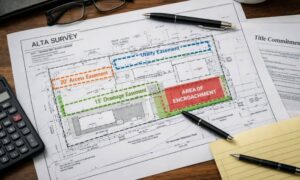
Thinking of buying, building, or investing in Atlanta? Zoning laws determine how land can be used, and a land survey ensures you stay compliant. Avoid costly mistakes by understanding Atlanta’s zoning rules, property boundaries, and why surveys matter.
Zoning Laws in Atlanta
Zoning laws are regulations that define how properties in specific geographic zones can be used. They separate areas into residential, commercial, industrial, and mixed-use zones to ensure organized development and land use.
Key Zoning Classifications:
- Residential (R-1 to R-5): Single-family to multifamily housing.
- Commercial (C-1, C-2): Retail businesses, offices.
- Industrial (I-1, I-2): Manufacturing, warehouses.
- Mixed-Use (MU): Combination of residential and commercial.
These classifications impact building size, placement, and usage.
Why Land Surveys Matter in Zoning Compliance
Land surveys are essential for:
- Determining Property Boundaries: Ensuring accurate property lines to prevent disputes.
- Identifying Zoning Compliance: Verifying that structures meet zoning regulations regarding setbacks and placements.
Types of Land Surveys for Zoning & Development
- Boundary Surveys: Establish property lines and identify encroachments.
- Topographic Surveys: Detail natural and man-made features, aiding in planning and design.
- ALTA/NSPS Land Title Surveys: Comprehensive surveys required for commercial property transactions, ensuring compliance with title requirements.
- Subdivision Surveys: Divide land into plots, ensuring adherence to zoning laws.
How to Check Zoning for Your Property in Atlanta
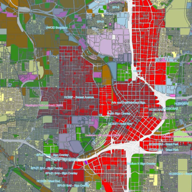
- Online Resources: Use the City of Atlanta’s Official Zoning Map to determine your property’s zoning classification.
- Contacting Authorities: Reach out to the City of Atlanta Department of City Planning for guidance.
Common Zoning Issues That Require a Survey
- Setback Violations: Building too close to property lines.
- Encroachments: Structures extending onto neighboring properties.
- Rezoning and Variance Applications: Modifying property use or seeking exceptions to zoning laws.
- Boundary Disputes: Conflicts over property lines.
Steps to Take If Your Property Doesn’t Meet Zoning Requirements
- Applying for a Zoning Variance: Requesting permission to deviate from zoning laws.
- Requesting a Rezoning: Changing the property’s zoning classification.
- Consulting Professionals: Engage land surveyors and zoning attorneys for expert advice.
FAQs
- How do I find my property’s zoning classification in Atlanta? Use the City of Atlanta’s Official Zoning Map or contact the Department of City Planning.
- What happens if I build on my property without following zoning laws? You may face fines, be required to alter or remove non-compliant structures, and encounter legal issues.
- How long does a land survey take in Atlanta? Typically, 1-2 weeks, depending on property size and survey complexity.
- Can a survey help if I have a boundary dispute with my neighbor? Yes, it provides an accurate representation of property lines, aiding in dispute resolution.
- How much does a zoning-related land survey cost in Atlanta? Costs vary based on property size and survey type; consult local surveyors for estimates.
