Welcome to ALTA Survey Georgia

Your Final Stop for Your ALTA Survey Needs!                              Contact us today for a free quote!

This site is intended to provide you with information on ALTA Surveying in Georgia. If you’re looking for a Georgia Land Surveyor, you’ve come to the right place. If you’d rather talk to someone about your land surveying needs, please call our toll-free number at (888) 808-9783 today. For more information, please continue to read.

ALTA Survey Georgia

Land Surveyors are professionals who make precise measurements to determine the size and boundaries of a piece of real estate.  While this is a simplistic definition, boundary surveying is one of the most common types of surveying related to home and land owners. If you fall into the following categories, please click on the appropriate link for more information on that subject:

ALTA Survey Georgia services:

    1. I need to know where my property corners or property lines are. (Boundary Survey)
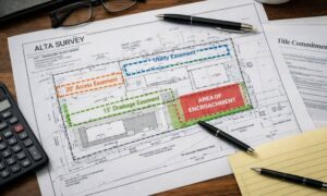
    2. I have a loan closing or re-finance coming up on my commercial property. (ALTA Survey)
    3. I need a map of my property with contour lines to show elevation differences for my architect or engineer. (Topo Survey – ALTA Survey plus Table A Item 5.)
    4. I’ve just been told I’m in a flood zone or I’ve been told I need an elevation certificate in order to obtain flood insurance or prove I don’t need it. (Flood Survey)
    5. I’m purchasing a lot/property for a commercial use. (ALTA Survey – Item 5 and/or Item 11b may also need to be discussed.)
    6. I’m purchasing a larger tract of land, acreage, that hasn’t been subdivided in the past. (Boundary Survey)
author avatar
Surveyor

More Posts

Land surveying instrument set up in front of a residential home, capturing elevation and boundary data for a property survey in Carrollton, GA.
land surveyor
Surveyor

What to Expect from a Land Surveyor 

Whether you’re buying property, building a fence, or starting construction, knowing exactly where your land begins and ends is essential. In Carrollton, GA, homeowners, builders, and developers rely on a land surveyor to define property boundaries, identify elevation issues, and support permit applications. This article breaks down when to hire

Read More »

When Do You Need an ALTA Survey for Property Deals?

In real estate, accurate information is key—especially when buying or developing land. Whether you’re closing on a commercial building or planning a large development, land surveys help you understand what you’re working with. One type of survey stands out for complex property transactions: the ALTA survey. This form of survey

Read More »

Using an Elevation Certificate for Multi-Tiered Sites

An elevation certificate is essential when building on sloped or multi-tiered land. It provides accurate elevation data that helps set reference points for each level of the site—such as patios, driveways, foundations, and retaining walls. These certified points ensure that every structure lines up safely and properly. In Warner Robins,

Read More »

How LiDAR Mapping Helps Prevent Drainage and Erosion Problems

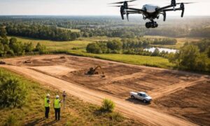
LiDAR mapping is quickly becoming one of the most reliable tools for preventing drainage and erosion issues in both residential and commercial developments. By capturing highly accurate elevation data, it helps builders, engineers, and property owners understand how water flows across a site—before costly problems arise. Whether you’re planning new

Read More »

Why LiDAR Mapping is Essential for Utility Projects

Installing utilities in hilly or sloped areas can be risky without the right elevation data. That’s why LiDAR mapping in Ringgold is now a go-to tool for builders and utility planners. Mistakes in utility planning can lead to costly rework, safety hazards, and inspection failures. That’s why more engineers and

Read More »

Using FEMA Elevation Certificates for Sustainable Land Reuse Planning

In Atlanta’s older neighborhoods, many abandoned or underused lots are now prime targets for new homes, shops, or mixed-use developments. However, these opportunities come with hidden risks—especially when lots are located in low-lying areas or near flood zones. To protect projects from costly delays and compliance issues, developers need more

Read More »