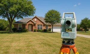

In Atlanta’s older neighborhoods, many abandoned or underused lots are now prime targets for new homes, shops, or mixed-use developments. However, these opportunities come with hidden risks—especially when lots are located in low-lying areas or near flood zones. To protect projects from costly delays and compliance issues, developers need more than great designs. They need accurate elevation data verified through FEMA Elevation Certificates, which document the relationship between the land and floodplain requirements.
Urban Lot Reuse and Flood Risk in Atlanta’s Evolving Neighborhoods
As the city grows, vacant and underused properties in older areas are being reactivated for new projects. Many of these reuse lots lie near creeks, stormwater paths, or outdated drainage systems. Builders face major risks when elevation data is missing or out of date.
These low-lying parcels often need elevation correction, which can make or break a site’s value. Without good data, the lot may fail during permit review or require expensive fixes later.
Establishing Reliable Ground Benchmarks Before Redevelopment
Before anything is designed or submitted, teams should collect elevation data that reflects the current grade of the site. FEMA elevation certificates help confirm where the lot sits in relation to the base flood elevation (BFE).
Having these benchmarks early helps builders:
- Plan correct slab or foundation heights
- Check if fill or grading is needed
- Avoid delays tied to flood zone requirements
Designing Site Layouts That Work with Existing Drainage Paths
Some reuse lots sit along natural slopes or near older runoff routes. Using elevation data, developers can adjust their layouts to protect drainage flow.
Examples of site design changes may include:
- Shifting building pads to avoid runoff buildup
- Adding swales or retaining walls in low points
- Adjusting setbacks to protect stormwater paths
This helps prevent erosion, pooling, and stormwater violations.
Coordination of Zoning Compliance with Vertical Design Requirements
In Atlanta, zoning rules often intersect with floodplain rules. Successful projects rely on smart elevation planning for flood zone compliance to ensure that slab heights, drainage, and vertical setbacks meet both city and FEMA requirements.
Certified elevation helps teams:
- Measure compliance with minimum slab height
- Avoid blocking nearby drainage with poor grading
- Coordinate with utilities that require specific elevation alignment
This vertical review is just as important as checking lot width or building coverage.
Documentation to Support Permit Review and Environmental Safeguards
Atlanta requires full documentation for any project within or near a flood zone. Certified elevation benchmarks, prepared by experts in professional land surveying in Georgia, are a critical part of that process.
Permit reviewers look for:
- Accurate site elevation before grading
- Drainage plans that reflect true grade
- FEMA-compliant documentation for review and inspection
When these items are done early, approvals move faster and with fewer surprises.
Economic Development Trends Influencing Land Reuse in Atlanta
Across Atlanta, land near transit, schools, and commercial corridors is in high demand. Many of these spots were once avoided due to drainage or flood concerns but new codes and investment are changing that.
- Infill development is rising in older neighborhoods
- Developers are reexamining small or sloped parcels
- Infrastructure upgrades are making more flood-prone areas viable
This trend means elevation planning is more critical than ever before.
FAQs
1. Why is elevation data important for reused lots in Atlanta?
It shows how the land sits in relation to flood zones and helps builders avoid drainage or permitting problems.
2. When should I get an elevation certificate?
Before site design begins especially if the lot is in or near a FEMA flood zone.
3. Can elevation certificates help during permit review?
Yes. They are often required for permit approval and help speed up the review process.
4. What happens if I build without elevation planning?
You may face failed inspections, drainage problems, or costly rebuilds if the site doesn’t meet code.
5. Is elevation data only needed for flood zones?
No. It’s useful on any site where grading, drainage, or height alignment matters.