Installing utilities in hilly or sloped areas can be risky without the right elevation data. That’s why LiDAR mapping in Ringgold is now a go-to tool for builders and utility planners. Mistakes in utility planning can lead to costly rework, safety hazards, and inspection failures.
That’s why more engineers and contractors are relying on LiDAR-based elevation surveys to streamline their utility layout plans. This technology provides fast, accurate, and high-resolution elevation data that improves design accuracy and reduces construction risk.
Challenges in Utility Planning for Ringgold’s Terrain
- Elevation Changes and Sloped Lots. Ringgold’s landscape isn’t flat—many properties include hills, slopes, and drainage basins. Traditional surveying may overlook critical elevation changes that affect the depth and routing of underground lines. These details are vital when determining flow direction for sewer systems or slope for gravity-fed lines.
- Risks of Inaccurate or Outdated Elevation Data. Outdated elevation maps can misrepresent lot conditions, leading to trenching errors or violations of local building codes. Installing utilities without accurate grade information increases the risk of hitting existing lines, violating easements, or causing future water drainage problems.
What Is a LiDAR-Based Elevation Survey?
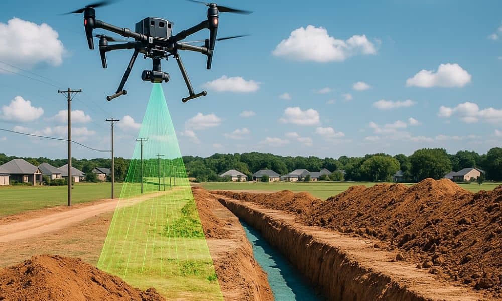
LiDAR (Light Detection and Ranging) uses laser pulses to measure distances between the scanner and ground surfaces. Mounted on drones, this technology can scan large areas quickly and create a 3D model of the terrain.
For utility planning, LiDAR provides critical elevation details, including slope, grade, and surface features. This data is then integrated into engineering software, allowing utility planners to map precise trench paths, avoid conflicts, and meet regulatory standards.
Benefits of Using LiDAR for Utility Installations
Accurate Depth and Grade Analysis
Knowing the exact elevation of every point on a property ensures that pipelines or cables are installed at the correct depth. This is essential for preventing freezing, pipe collapse, or surface damage.
Time and Cost Efficiency
Drone-based LiDAR surveys cover areas in a fraction of the time compared to manual surveying. Crews spend less time on-site, and planners receive data sooner—allowing for quicker design iterations and permitting.
Using LiDAR-based elevation mapping, utility teams can gather detailed grade information quickly, reducing project delays and overall labor costs.
Improved Safety and Compliance
Utility lines that are poorly placed pose long-term safety risks. With accurate LiDAR data, teams can comply with local codes and avoid accidental line overlaps or insufficient clearances.
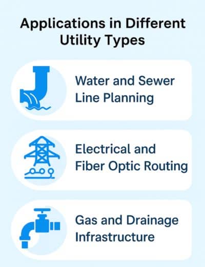
Applications in Different Utility Types

- Water and Sewer Line Planning
Water and sewer systems rely heavily on proper slope and depth. LiDAR helps calculate gravity-fed flow paths, trench angles, and manhole locations, even on uneven lots.
- Electrical and Fiber Optic Routing
Above-ground and buried lines both benefit from LiDAR’s elevation data. Engineers can identify the best paths for conduits, poles, and transformers while minimizing disruption to the surrounding terrain.
- Gas and Drainage Infrastructure
Gas lines must follow strict setback and clearance rules. LiDAR helps planners map these routes with confidence, even when terrain changes affect routing angles or pipe bend requirements.
Avoiding Common Setback and Easement Issues
1. How LiDAR Aids Right-of-Way Mapping
Public utilities often require precise placement within rights-of-way or utility easements. LiDAR-based elevation surveys help define these legal boundaries accurately, reducing the chance of building across a setback or digging outside permitted zones.
2. Planning for Underground and Overhead Clearance
LiDAR also helps identify vertical constraints—such as low-hanging tree limbs, utility poles, or buildings—that might interfere with installation. Planners can adjust their routes before construction begins, saving time and avoiding conflicts.
Case Examples in Ringgold Utility Projects
- Subdivision Development. In newer subdivisions around Ringgold, developers use LiDAR data to pre-map utility corridors across multiple lots. This allows coordinated trenching and reduces costly overlaps or misroutes.
- Rural Utility Layouts. Rural landowners often face challenges with uneven terrain and longer utility runs. LiDAR surveys help determine the best access points for power and water lines, even when roads or driveways haven’t been developed yet.
Integrating LiDAR with GIS and Engineering Tools
LiDAR data can be imported into GIS (Geographic Information Systems) and CAD (Computer-Aided Design) software to:
- Visualize trench routes in 3D
- Overlay utility lines with topographic maps
- Model grading and flow paths for drainage systems
This kind of integration makes utility planning with LiDAR more efficient and collaborative, helping planners avoid mistakes before construction begins.
Choosing the Right LiDAR Mapping Service
What to Look For
- Experience with utility-specific projects
- High-resolution scanning capabilities
- Integration support with GIS and CAD tools
- Understanding of local regulations in Georgia
Questions to Ask Before Hiring
- Do you offer post-processing and engineering-ready data?
- Can you provide contour maps, DEMs, or 3D terrain models?
- How quickly can we receive deliverables?
Working with a knowledgeable provider ensures the data you receive is not just accurate—but usable.
Future of Utility Planning with LiDAR Technology
As cities like Ringgold continue to grow, the demand for smart infrastructure will increase. LiDAR’s role in utility planning will expand through:
- AI-powered trench routing
- Predictive conflict detection
- Real-time progress monitoring via drones
The future points to faster, safer, and more accurate utility design—and LiDAR is leading the way.
FAQs
1. Can LiDAR replace traditional utility surveys?
LiDAR enhances, not replaces, traditional methods. It offers faster coverage and detailed elevation data to support utility design.
2. Is LiDAR useful for both above and underground utilities?
Yes. It helps plan routes, identify clearance issues, and avoid interference—even for underground trenching.
3. How accurate is a LiDAR-based survey?
Most drone LiDAR systems used for utility planning offer accuracy within a few centimeters—more than enough for construction-grade mapping.
4. Do I need LiDAR for a small property?
Even small projects benefit from clear, fast elevation data—especially if there are slopes, drainage concerns, or easement issues.
5. Can LiDAR detect existing underground pipes?
No, but it helps you avoid damaging them by showing surface-level clues and combining with utility markouts.
6. How long does a LiDAR elevation survey take?
Most projects are scanned in a day, with deliverables ready within 2–5 business days depending on size and complexity.