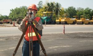
Land surveying has come a long way. What used to take weeks with measuring tapes, total stations, and boots on the ground can now be done in hours thanks to new technologies. At the forefront of this change is LiDAR mapping—a tool that’s helping surveyors work faster, safer, and with incredible detail.
Whether you’re surveying a dense forest or an urban construction site, LiDAR is making it easier to get the job done. But how exactly is it transforming the field? Let’s take a closer look.
What Is LiDAR Mapping and How Does It Work?
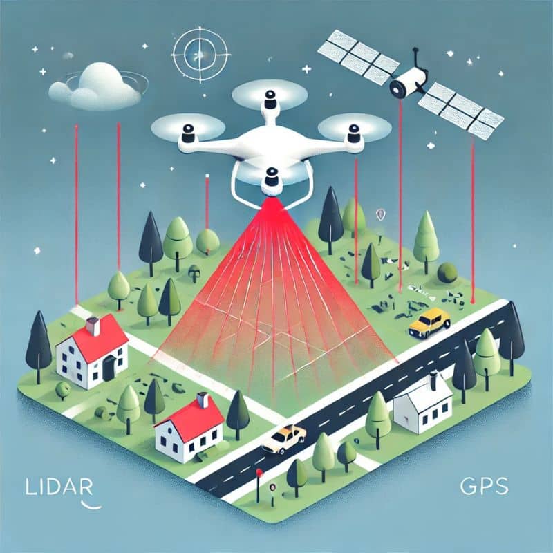
LiDAR stands for Light Detection and Ranging. It works by sending out laser pulses from a sensor—often mounted on a drone, helicopter, or vehicle—and measuring how long it takes for the light to bounce back.
This time delay is used to calculate distance, which allows the system to create highly detailed 3D maps of the landscape. The result? You get a massive collection of data points known as a point cloud, which gives a complete view of the terrain, including ground surfaces, buildings, and vegetation.
LiDAR systems typically include:
- Laser sensor
- GPS receiver
- Inertial measurement unit (IMU)
- Advanced data processing software
All of this works together to deliver precise location data across large areas—fast.
What Makes LiDAR So Useful for Surveyors
Let’s break down how LiDAR mapping in land surveying is changing the game:
1. Increased Accuracy and Data Density
Traditional surveying tools are great for pinpoint accuracy, but they can only capture a limited number of points at a time. LiDAR, on the other hand, collects thousands of measurements per second.
That means surveyors get dense, detailed data—especially useful for creating elevation models, planning site grades, and managing drainage systems.
2. Faster Turnaround Times for Fieldwork
With LiDAR, you can scan an entire site in hours instead of days. The speed is especially helpful on large projects or when working on tight deadlines.
- Bonus: Less time in the field = less exposure to bad weather or on-site hazards.
3. Safer Data Collection in Risky Environments
Surveyors often work in places that aren’t exactly safe—think highways, cliffs, or flood zones. With LiDAR mounted on drones or vehicles, much of the work can be done remotely.
This cuts down the time surveyors spend in dangerous conditions, keeping crews safer while still collecting everything needed.
4. Access to Hard-to-Reach or Vegetated Areas
One of the most powerful features of LiDAR is its ability to “see through” vegetation. Unlike photogrammetry, which struggles under dense tree cover, LiDAR can still detect the ground surface.
This makes it the go-to tool for:
- Forestry mapping
- Wilderness surveys
- Archaeological site analysis
5. Integration with Drones and UAVs
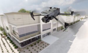
Combining LiDAR with drone technology gives surveyors even more flexibility. A UAV with a LiDAR payload can fly over rugged terrain, scan areas without road access, and reach places where human crews can’t go easily.
- Time-saving? Yes.
- Efficient? Absolutely.
6. High-Quality Digital Terrain and Surface Models
All that data LiDAR collects turns into valuable digital products—like digital elevation models (DEMs) and digital surface models (DSMs). These are essential for:
- Site planning
- Water runoff analysis
- Volume measurements (like for excavation or fill)
And they’re ready to be plugged into CAD, GIS, or BIM systems used in design and planning.
Real-World Applications in Surveying Projects
- Topographic Mapping: For grading, zoning, and land development
- Transportation Planning: Highways, rail lines, and bridges
- Flood Risk Analysis: Mapping riverbanks and elevation for flood models
- Utility Corridor Surveys: For powerlines, pipelines, and communication networks
These are just a few of the many ways surveyors are using LiDAR to work smarter—not harder.
Challenges and Limitations of LiDAR in Surveying
While LiDAR is powerful, it’s not without its challenges:
- Initial Equipment Cost: High-quality LiDAR systems can be expensive, though costs are coming down as tech evolves.
- Data Processing Expertise: Working with point clouds takes the right software—and the right skills.
- Environmental Factors: Things like heavy rain or fog can affect data quality, depending on the system used.
Despite these drawbacks, the benefits often far outweigh the limitations for many projects.
The Future of Land Surveying with LiDAR Technology
As technology continues to grow, so does the role of LiDAR in surveying. Here’s what we might see in the near future:
- Real-time processing: Instant models generated as data is collected.
- AI-enhanced analysis: Smarter sorting of point cloud data.
- More accessible tools: Compact, affordable systems for small teams or individual contractors.
LiDAR is not just a trend—it’s a transformation. And it’s one that’s here to stay.
FAQs
1. How does LiDAR differ from photogrammetry?
Photogrammetry uses photos to create maps, while LiDAR uses laser pulses. LiDAR works better in vegetated or shadowed areas.
2. Is LiDAR suitable for small projects?
Yes, especially with drone-mounted systems. It depends on the size, budget, and accuracy needed.
3. Can LiDAR replace traditional surveying tools?
It complements them but doesn’t fully replace them—especially for property boundaries and legal documentation.
4. How accurate is LiDAR data?
Modern systems can be accurate within a few centimeters, depending on conditions and equipment.
5. What software is used to process LiDAR data?
Popular choices include Civil 3D, Global Mapper, Terrasolid, and ArcGIS.
6. Is LiDAR mapping legal everywhere?
Yes, but drone-based LiDAR requires you to follow local aviation regulations.
Final Thoughts: Embracing Innovation in Land Surveying
Technology like LiDAR mapping isn’t just helping surveyors work faster—it’s helping them work smarter. From better data to safer workflows and more efficient planning, the impact is real and growing.
If you’re in the surveying world and haven’t tapped into this yet, now’s the time. LiDAR is reshaping what’s possible—and putting the future of land surveying right in your hands.
