Building athletic fields involves more than installing grass and bleachers. Accurate ground elevation is critical before adding any structures like dugouts, restrooms, press boxes, or seating areas. Without the right elevation, projects risk water drainage issues, non-compliance with ADA standards, and permitting delays. An Elevation Certificate helps confirm that all structures within an athletic field facility meet necessary height and grading requirements. It’s an essential step for schools, parks, and organizations planning new sports facilities, ensuring smoother approvals and safer, more functional spaces.
Elevation Relevance in Modern Athletic Facility Design
When adding buildings or structures to a sports field, elevation is a key part of the plan. If the ground is too low or too uneven, it can cause flooding, poor access, or safety issues.
Reasons elevation matters:
- Ensures safe, level surfaces for spectators and athletes
- Helps water drain away from important areas
- Meets city and ADA requirements for public access
Schools and park departments in Newnan often require elevation certificates before they approve new structures.
Defining Survey Points for Key Athletic Field Structures
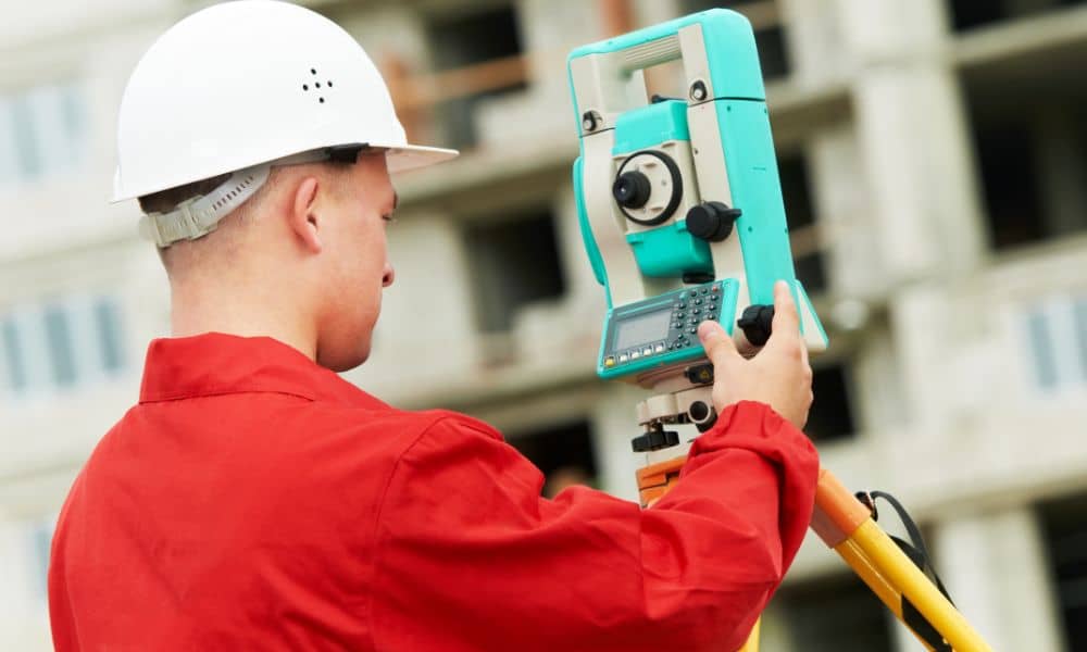
Surveying elevation points for sports fields is critical to ensure that all structures are placed at the correct height. Surveyors check the height of the land in many parts of the facility—not just the field. These points include:
- Concrete pads for dugouts, locker rooms, and shade structures
- Bases of bleachers or press boxes
- Entry spots near sidewalks, ramps, and parking lots
Each point helps confirm that buildings and features are placed correctly and meet the design plan.
Preventing Water Intrusion and Surface Runoff in Sports Zones
Sports fields need to stay dry and safe. If water collects near buildings or playing areas, it can cause damage or delays. Elevation certificates help show that the land is shaped the right way for water to drain.
Things that elevation data can help with:
- Avoiding puddles near restrooms or seating
- Matching field slopes with nearby storm drains
- Making sure turf and tracks don’t hold water after rain
With the right plan, you can stop water problems before they start.
Meeting Municipal and School System Elevation Compliance
Cities and schools often have rules about how high or low buildings can sit on a site. An elevation certificate helps prove you’re meeting those rules.
You may need an elevation certificate to:
- Get a building permit
- Show your project is ADA-compliant
- Meet FEMA flood zone guidelines
Without the certificate, you may face delays, extra costs, or failed inspections.
Coordinating Certificate Data with Site Design and Facility Layout
Once the elevation data is ready, it’s shared with the full project team. This helps with tasks like:
- Setting the right height for concession stands and equipment rooms
- Building safe slopes and drainage paths
- Aligning fences, sidewalks, and lighting systems
Ensuring Post-Construction Certification Matches As-Built Elevations
After the project is finished, post-construction elevation verification is performed by surveyors to confirm that everything was built at the correct height. If the elevation is off, changes may need to be made before final approval.
Post-build steps include:
- Recording final elevation measurements
- Comparing them with original design data
- Submitting the final elevation certificate for approval
FAQ’s
1. Is an elevation certificate needed for bleachers or restrooms on athletic fields?
Yes. Permanent structures such as bleachers, restrooms, and press boxes, especially in public parks or school zones, typically require an elevation certificate to meet local codes and safety standards.
2. How does elevation affect water drainage on sports fields?
Proper elevation ensures that water flows away from critical areas like playing fields, restrooms, and walkways. Good elevation planning helps prevent puddling, erosion, and unsafe conditions after rainfall.
3. Who usually requires the elevation certificate?
City building departments, school districts, engineers, and inspectors often require an elevation certificate to verify compliance with design standards, ADA accessibility, and floodplain management regulations.
4. Can elevation certificates help prevent construction delays?
Yes. Having verified elevation data early in the project helps avoid last-minute corrections, permitting issues, and failed inspections, which can cause costly construction delays.
5. Why is post-construction elevation verification important?
Post-construction verification confirms that all built structures match the approved design elevations, ensuring compliance with safety codes and making final inspections and approvals smoother.


