
You’re ready to build something on your property. Maybe it’s an addition, a new driveway, or clearing part of the lot. So you check your files, thinking you probably have a copy of your boundary survey tucked away somewhere.
But it’s not there.
That moment catches people off guard. Most property owners in Savannah assume every lot has a clear, easy-to-find record of its boundaries. It seems like it should work that way, but it doesn’t.
A boundary survey may exist, but it’s not always easy to track down. Sometimes it stays with a past owner, a lender, or an attorney. In other cases, it was never recorded at all. That gap creates confusion right when you need clear answers.
Before moving forward with any project, it helps to understand why this happens and what it means for your property.
Why Your Boundary Survey May Not Be on File
A boundary survey does not always end up in public records. That’s the first surprise for most people.
Surveys are often created for one specific moment, like a home purchase or a loan. After that, the document goes to the buyer, the lender, or the attorney. It doesn’t always get filed with the county.
Over time, those documents get lost, forgotten, or buried in old paperwork.
This happens more often in Savannah because many properties are older. Some homes have changed hands many times. Each owner may have relied on past information without updating anything.
So when you try to find a survey years later, there may be nothing easy to access.
That does not mean your boundaries are unclear. It just means you don’t have a reliable record in hand.
Why Online Maps Don’t Solve the Problem
When people can’t find a survey, they usually check online maps.
They zoom in on parcel lines and assume those lines match the real property. It feels like a quick answer.
It’s not.
Those maps give a general layout, not exact boundaries. The lines can be off by several feet. That might not sound like a big deal, but it becomes one fast when you build close to the edge of your property.
Relying on those maps alone creates a false sense of confidence. You think you know where your line is, but you don’t have proof that holds up in real conditions.
That’s where a boundary survey still matters.
Why This Becomes a Problem Right Before Building
This issue usually shows up at the worst time.
You already have a plan. You’re ready to move forward. Then you realize you don’t have a clear boundary to work from.
Now everything slows down.
You can’t be sure how far you can build. You don’t know how close you are to the edge of your lot. Your contractor doesn’t have a fixed reference point.
So instead of moving ahead, you pause and try to figure things out.
A boundary survey removes that uncertainty early. It gives you a clear starting point before any work begins.
How a Boundary Survey Helps You Move Forward
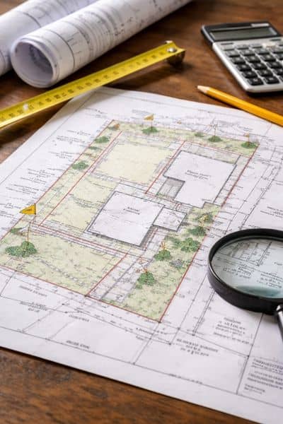
A boundary survey shows the true shape and limits of your property.
It marks the corners. It defines the lines. It shows how your lot sits in relation to nearby structures.
That clarity changes how you plan.
You can place your project with confidence. You know how much space you actually have. Your contractor works from real data instead of guesswork.
That one step keeps the project on track from the start.
Why This Happens More Often in Savannah
Savannah has a lot of character, but that also means complexity.
Many properties have older layouts. Some lots are not perfect rectangles. Some boundaries come from older legal descriptions that don’t match modern mapping tools.
In some cases, past work happened without updated surveys. Over time, those small gaps in information build up.
One owner assumes a line is correct. The next owner does the same. Years pass, and no one checks it until a new project begins.
That’s when the missing survey becomes a real issue.
What Property Owners Should Do Before Starting a Project
Start simple. Look through your closing documents first. A survey might already be there.
If you don’t find one, reach out to your title company or lender. They sometimes keep copies.
If nothing turns up, talk to a local surveyor. They can review your situation and tell you if an existing survey could still work or if you need a new one.
In many cases, getting a new boundary survey is the fastest way forward. It gives you current, accurate information you can rely on.
Why Acting Early Saves Time and Money
Waiting too long to deal with this creates problems.
Plans may need to change. Work may need to stop. Costs can rise when adjustments happen late in the process.
When you handle it early, everything runs smoother. You make decisions based on real information, not assumptions.
That keeps your project moving without surprises.
Before You Build, Make Sure You Know Your Boundaries
Not finding a survey feels like a small issue at first. It’s not.
It affects how you plan, where you build, and how confident you feel moving forward.
A boundary survey gives you a clear picture of your property. It removes doubt and gives you a solid starting point.
If you’re planning any type of improvement, check for a survey first. If you can’t find one, take the next step and get one done.
That simple move can save you from delays, confusion, and costly changes later.